
Turquoise Trail National Scenic Byway
Why take the fast-paced interstate between Albuquerque and Santa Fe, when you can take an adventure into the past along the Turquoise Trail? With 61.2 miles of back-roads, including Highway 14 and NM-536, the National Scenic Byway passes through colorful and history-rich towns, offering visitors everything from arts and crafts to tours of Old West movie sets and ghost towns.
The trail begins on NM-536 at the summit of the Sandia Mountains, with an amazing view of the state. Here one can ski in the winter, and hike or bike in the summer. Upon descent, visitors take Highway 14 north to Golden, a ghost town named for the gold mining that occurred here during the 1800s. The trail continues on to Madrid, a former coal-mining town transformed into a myriad of shops and galleries offering arts and crafts. Events such as the Christmas celebration and numerous jazz concerts have made Madrid a favorite stopping place along the Turquoise Trail. The next stop is the turquoise and stone mining town of Cerrillos, with the oldest known mine in North America. Cerrillos offers a mining museum, a petting zoo, a trading post and the Cerrillos Station Mercantile Store and Art Gallery. The trail concludes in the historic City of Santa Fe.
Driving Directions
From Santa Fe take I-25 south to Highway 14 and continue to drive south. The stretch of Highway 14 between its intersection with I-40 and its destination in Santa Fe is the Turquoise Trail.

Nambé Falls & Lake Recreation Area
With its stunning double-drop waterfall as well as opportunities for swimming, lake fishing and camping, Nambé Falls & Lake Recreation Area is a great place for family fun. Serene and beautiful, the area sits above Nambé Pueblo, where the July 4th Nambé Falls Ceremonial, with dances and an arts and crafts fair, is a popular festivity for pueblo dwellers and tourists.
Driving Directions
Follow 285/84 north, heading towards Española. Bear to the right just after the Pojoaque Pueblo (HWY 68). Go about a quarter of a mile to the light and turn right on NM 503. Follow 503 about 3 miles until you see sign on right for Nambé Falls.

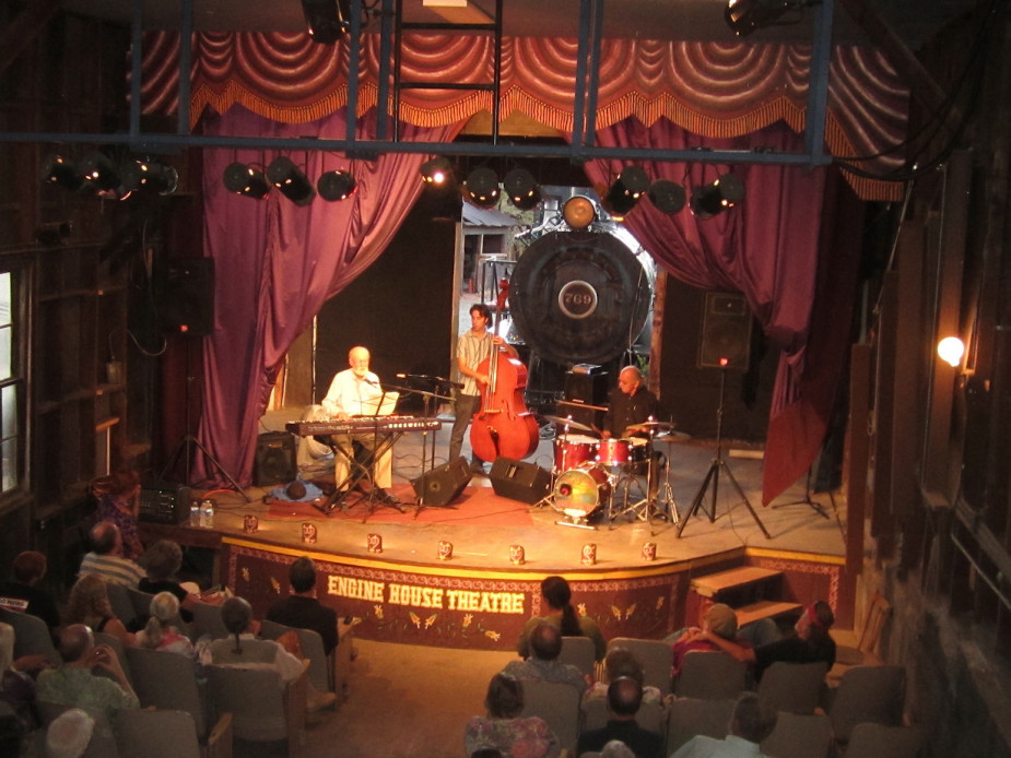
Engine House Theater In Madrid
In the heart of the old mining town of Madrid sits the Engine House Theater, a rollicking place to take in a classic, Victorian, or Western melodrama, whatever your age. You’ll laugh, you’ll cry, you’ll boo and hiss the villain, but ultimately, you’ll leave this theater filled with hope and happiness.
2846 State Highway 14 N
Madrid, NM 87010
505.438.3780
TurquoiseTrail.org/EngineHouseTheatre
La Bajada Hill
At this formidable landmark, with a dramatic 1300-foot ascent to Santa Fe, the Spanish divided their colonies into the Rio Arriba (Upper River) and Rio Abajo (Lower River). Traversing La Bajada Hill Road was once an arduous trip but, in the 1930s, the Highway Department moved the road three miles to the east to the same route currently used by I-25. You can still see petroglyphs, wagon ruts, and the initials of drivers who climbed the hill in the early 1910s and 1920s, remnants of the long history of travel up the hill.
Driving Directions
Take I-25 to the Cochiti Pueblo exit/NM-16. Travel west on NM-16 for 3.5 miles. Turn right on the Tetilla Peak Recreation Area road. After one mile, turn right onto an unmarked dirt road, continue 1.5 miles, and park past the bridge over the Santa Fe River. The old road turns right from the bridge.
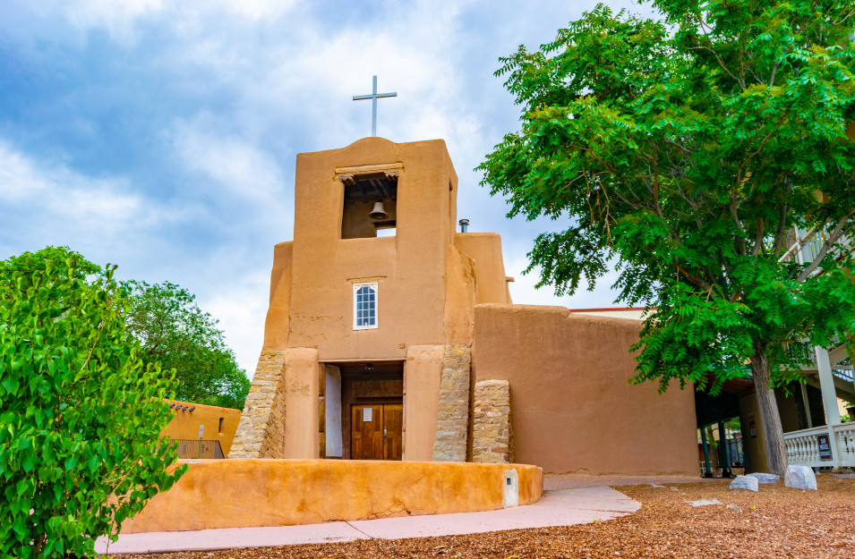
San Miguel Mission
Constructed in 1610 by the Tlaxcalan Indians of Mexico, who came to New Mexico as servants of the Spanish, this is the oldest church still in use in the country. In the anteroom, view a bell cast in Spain in 1356. It was used in churches in Spain and Mexico before being brought to Santa Fe by oxcart in the early 19th century. Priceless ornaments and paintings adorn the interior of the mission.
401 Old Santa Fe Trail
Santa Fe, NM 87501
505.988.9504

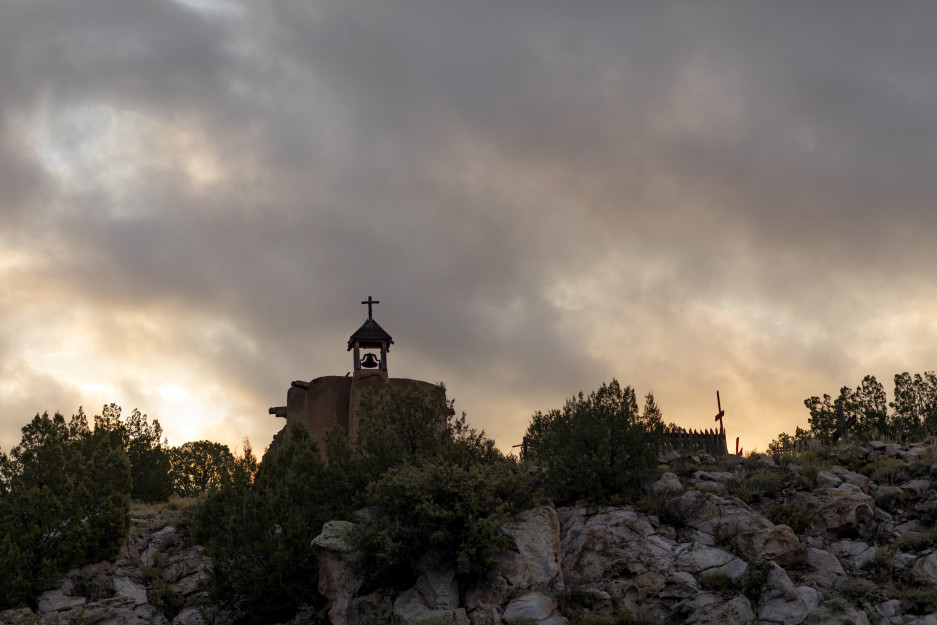
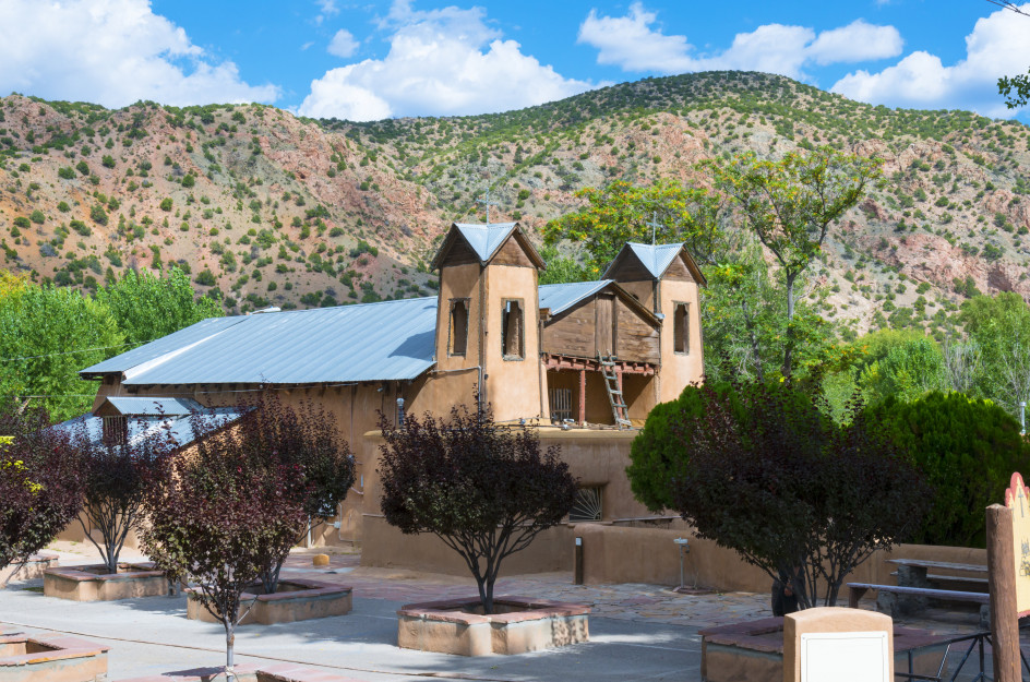
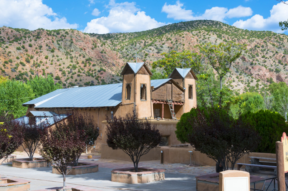
El Santuario De Chimayó
High in the foothills of the Sangre de Cristo Mountains some 40 miles north of Santa Fe, El Santuario de Chimayó is considered one of the truly holy places in America. Known as the “Lourdes of America,” the tiny mission church is a center for many points of pilgrimage and prayer. Built on a site believed by several cultures and faiths to have miraculous healing powers, the church draws thousands of people making a pilgrimage each year during Holy Week. Visitors are always welcome.
15 Santuario Dr
Chimayo, NM 87522
505.351.9961
El Rancho De Las Golondrinas
This acclaimed living history museum, dedicated to the heritage and culture of Spanish Colonial New Mexico, reveals how life was lived in early New Mexico. Located on 200 acres in a rural farming valley south of Santa Fe, the museum features 18th-century colonial buildings and villagers clothed in the styles of the times . Annual festivals and theme weekends give visitors an in-depth look at the celebrations, music, dance, food and other aspects of life in the period when this part of the U.S. was ruled by Spain and Mexico.
334 Los Pinos Road
Santa Fe, NM 87507
505.471.2261
Golondrinas.org

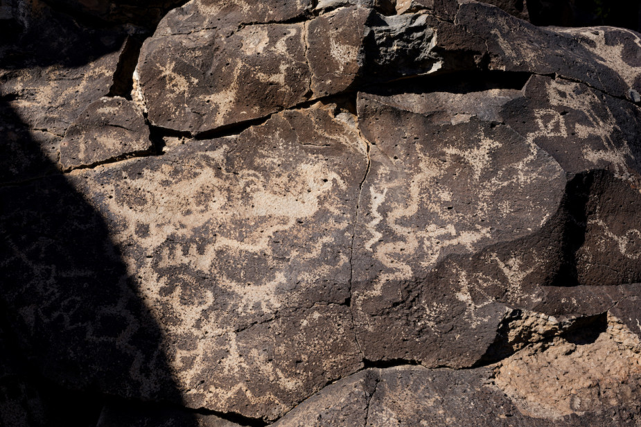
La Cieneguilla Petroglyph Site
Journey deep into the past at La Cieneguilla Petroglyph Site, filled with hundreds of petroglyphs along the mesa above the Santa Fe River carved by ancestral Puebloan people between the 13th and 17th centuries. The site is famous for many images of Kokopelli, the hump-backed flute player, and variety of bird figures.The ancient roadway, El Camino Real de Tierra Adentro, passed through here as well. You’ll find great hiking trails in the area.
Driving Directions:
From I-25 take exit 599, continue west on Airport Road for 3.3 miles. There is a gravel parking area on the west side of the road and a BLM sign. Follow a trail marked by arrows for about five to ten minutes to access the basalt cliffs where the petroglyphs are located.
662-674 Paseo Real
Santa Fe, NM 87507
BLM.gov/La_Cieneguilla